White Pocket Arizona – Guide to the Best Wave Alternative
I know, I know. You want to go to the Wave. We all do. But there are only 20 lucky people a day who can score a permit. And the lottery is brutal. As in, “people crying in the BLM office” brutal. I know; I’ve seen it. But let me tell you a secret; at least it’s still sort of secret.
You can see the same magnificent rock formations, including waves, at White Pocket in Vermilion Cliffs National Monument. And you don’t need a permit. For now.
Some posts on this site contain affiliate links, meaning if you book or buy something through one of these links, I may earn a small commission (at no extra cost to you!). Opinions are always my own and I’ll never promote something I don’t use or believe in. Also as an Amazon Associate I earn from qualifying purchases.
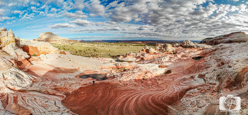
I am lucky enough to be married to a landscape photographer who always does extensive research on locales. He found an entrepreneurial tour guide who understood the value of SEO and the magic of his surroundings in Kanab and that is how Mr. Misadventures discovered White Pocket.
Our initial excursion into White Pocket was with this local guide in 2012. Mr. Misadventures became so enamored when we visited during our 10-day road trip (in May 2012) that we returned to camp there for an overnight photography trip (in November 2012).
We’ve now visited White Pocket several times since 2012, and I wanted to let you in on this stunning alternative to the Wave. It is really tough to understand just how unique and gorgeous White Pocket is just in 2-dimensional photos. The best chance you have to understand and get a peek is through video and now I can finally share one – a Mr. Misadventures project with both drone and video content, take a peek:

What Is White Pocket?

Umm, nothing short of amazing. Oh, wait. You want the real answer!
The Paria Plateau is the main geographic feature of the Vermilion Cliffs National Monument near the Arizona/Utah border. Just a few miles from Coyote Buttes (North and South) and the Wave is White Pocket. As of 2020, you do not need a permit to access White Pocket, although that may change in the future as word gets out! Difficult access helps keep visitation down for now. Unless you hire a guide or take a tour, you need a high clearance 4×4 vehicle and good mapping skills to find White Pocket.
White Pocket consists of a small group of domes and ridges. It covers an area of about one square mile, although you will cover lots of miles traversing back and forth and up and down! A lot of the rock formations are delicate, and will eventually be destroyed by too many visitors, so it’s best to go sooner rather than later.
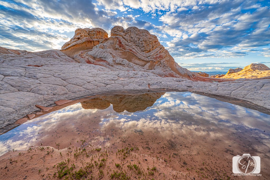
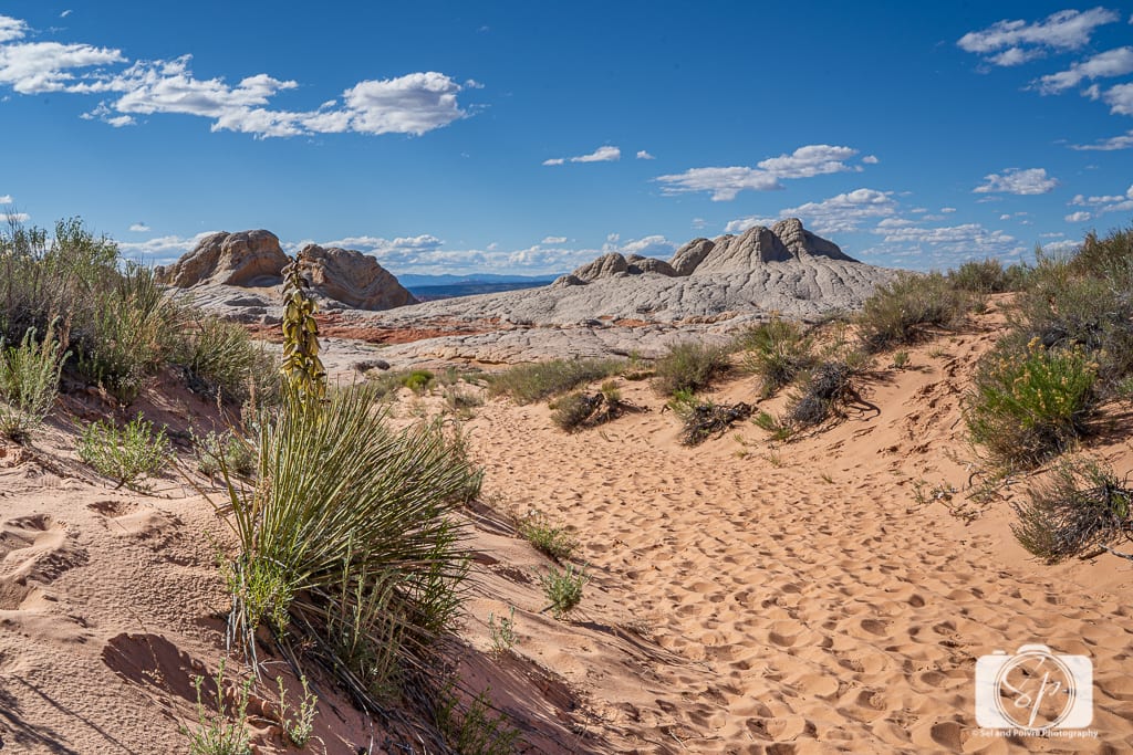
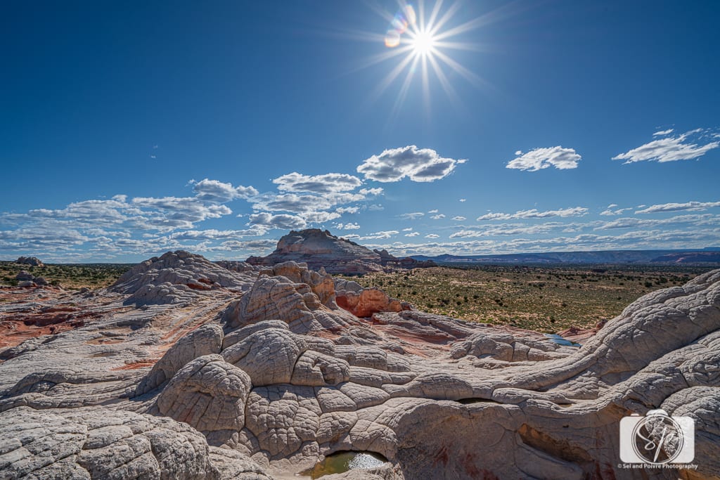
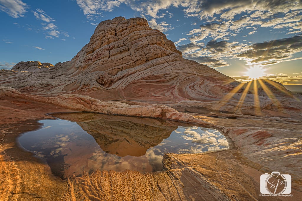
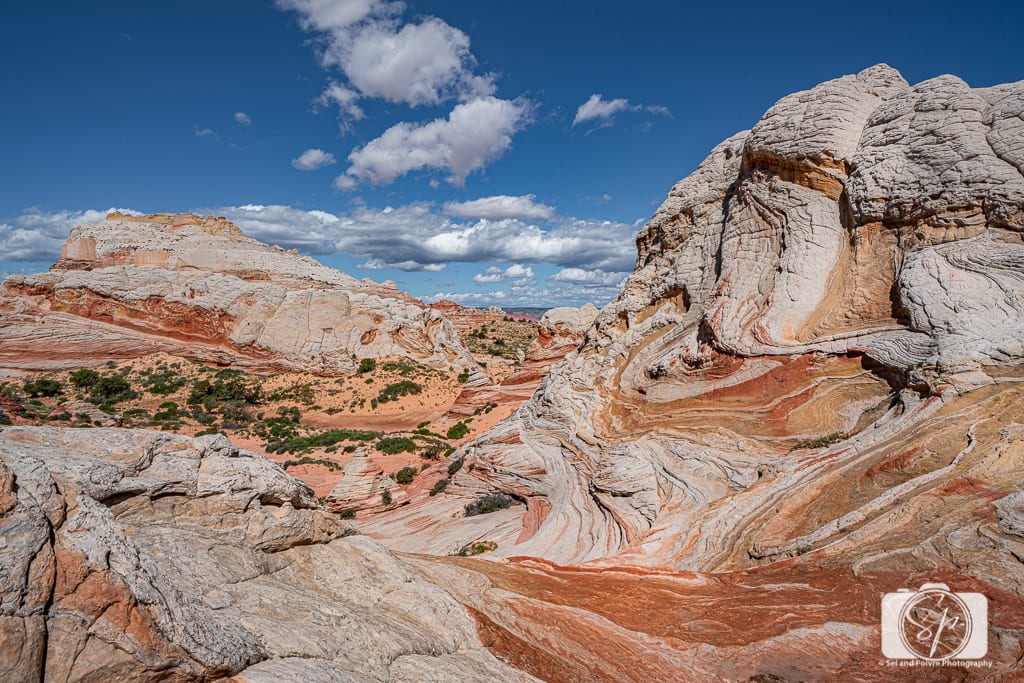
The white and red sandstone of White Pocket is mesmerizing. There are also yellow, orange, and pink formations! The white mounds that look like melted ice cream (or brains as Mr. Misadventures labeled them.) You’ll also see beehive-like cones, candy-striped rocks, and of course, waves. If you are lucky enough to visit White Pocket after it rains, pools of water are perfect for reflection photography. These are truly unique compositions and no matter what time of day you come there is something to photograph.
Photographing White Pocket
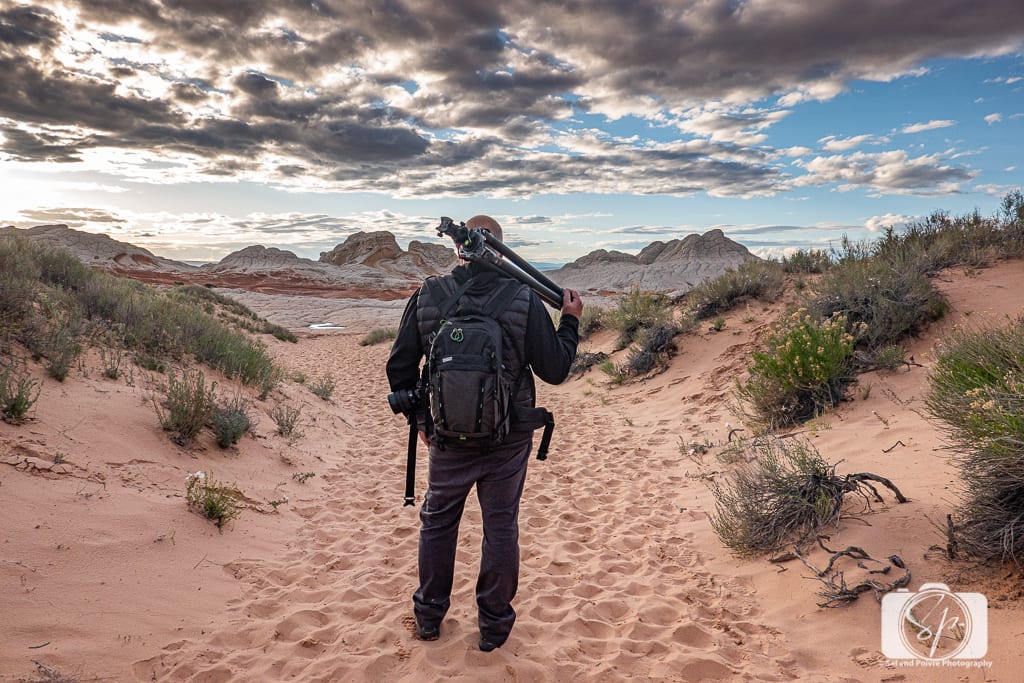
The best time to photograph White Pocket is from sunrise until about 10 am and then again from sunset until about an hour after. The middle part of the day is when the temperatures are the hottest and the bright sun will wash out any contrast. This is usually when tours come through as well, so we like to do some sunrise photography and then rest and rehydrate during mid-day until it’s time to go out and shoot again at sunset.
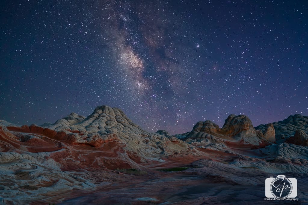
White Pocket is also fantastic for star photography! Particularly when the Milky Way is in season. Of course, sometimes you don’t have a choice about what time you visit. That’s okay, as the rock formations are pretty amazing all the time. You really can’t take a bad picture; you’ll just probably take a better one if you visit during prime lighting conditions.
White Pocket is a fantastic place to use a drone. It is not too crowded and the landscape is impressive from above. However, please make sure that you use your drone with courtesy. Mr. Misadventures is a photographer first and like many photographers who want to shoot at sunrise, sunset, or the blue hour, they may spend hours getting to the right spot, setting up the right angle, and then wait the big wait. There is nothing worse than having prepared for the perfect shot only to have it ruined by a drone. Thankfully at White Pocket, there is room for both, but I do not know how long that will last.
What's at White Pocket – What Can you Photograph at White Pocket
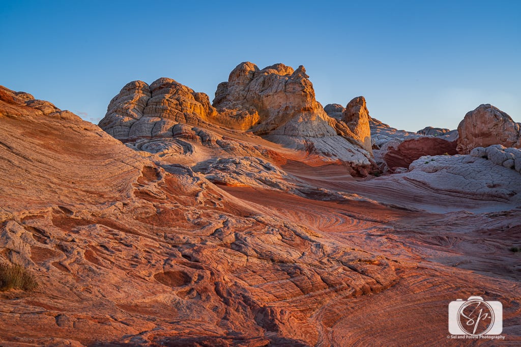
White Pocket is made up of layered sandstone made millions of years ago. Through time, wind, sand, and water compressed and hardened the minerals in the rock. The different colors are due to various mineral deposits built up over generations. Much of the top layer at White Pocket is, well white, and the sections or pockets of rock rise out of the desert.
Depending on the season, during your time at White Pocket you can photograph:
White Domes or Brain Rocks: My favorite part of White Pocket! Whether you call them melted ice cream, melted brains, or white domes, they are beautiful and funny!
 |  |  |
Hoodoos: I'd never seen or heard of a hoodoo until our first road trip to the Southwest. Hoodoos are rock formations that form a column or spire protruding from a badland base. They are also called chimneys, pyramids, or tent rocks, although obviously, hoodoo is the most fun to say!
 |  |  |
Waves, Gullies, Fins, Curves, and Swirls: the variety of rock formations in such a small space never ceases to amaze me. White Pocket is only 1 mile in length (although by the time you traverse the thing back and forth and up and down, I have found that I have clocked up to 8 miles in a single day!) but around every corner or down every slope there is something different to see.
 |  |  |
Tree #1 Ponderosa Pine: Located at 36°57'18.2″ N, 111°53'51.3″ W this tree is fun to photograph amongst the white domes during the day or at night.
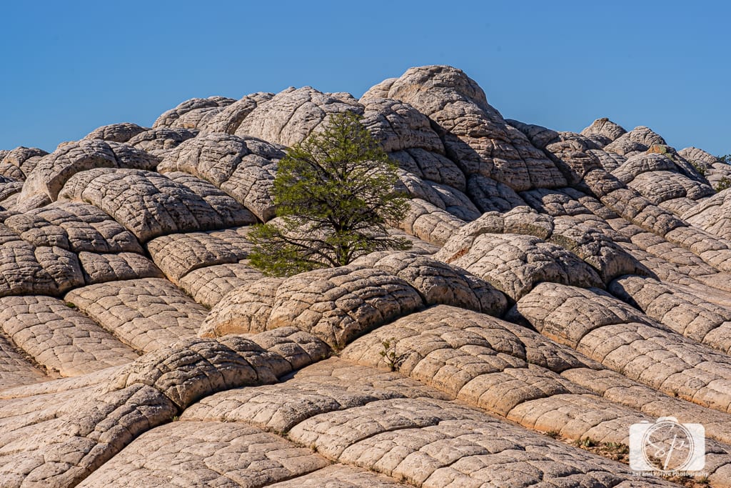
There is a second tree, a Utah Juniper located 36°57'15.8″ N, 111°53'52.2″ W, but in the 1000s of photos we took, I can't find a good one!
The Milky Way: Night photography is another great option at White Pocket. You will only get the Milky Way at certain times of the year, but it is worth the whole trip when it happens!
Spring flowers: Just like everywhere else in the desert, the bloom of spring flowers in White Pocket is pretty nice. They make a great foreground for photos!
 |  |  |
Water pools: Of all the trips we've been to White Pocket there has only been one where there was water collected in pools due to rain. You can imagine Mr. Misadventures' excitement in being able to photograph the clouds and rocks reflected in the water along with having a nice blue feature amongst the red sandstone.
 |  |  |
Petroglyphs: There is a small petroglyphs panel at the northeast edge of White Pocket (36°57'43.2″ N, 111°53'40.5″ W) which displays some animals and a few people, it looks to be a former dwelling area. We accessed by walking down to the other camping area (see below in the camping area) which we walked past and continued hiking White Pocket from that side of the area.

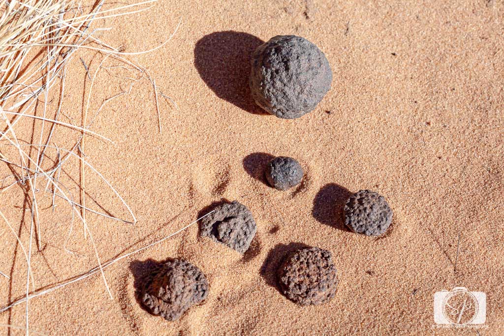
Moqui Marbles: Moqui marbles are pieces of iron concentrate and hematite which are over 180 million years old. That’s right I said millions. And they are everywhere!
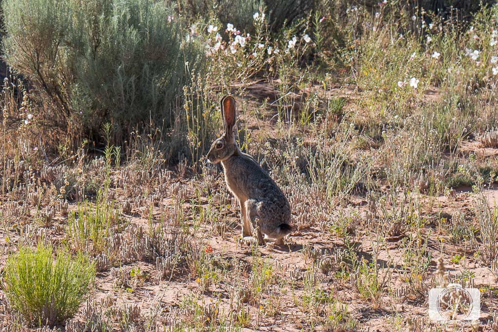
Wildlife: There are plenty of interesting birds, bugs, frogs (when there is water), and more, plus a rather large jackrabbit that checked us out every time we camped!
 |  |
White Pocket Tours
While we love off-road trips on our own, we’ve also had several great experiences with Dreamland Safari Tours. Dreamland Safari Tours provides guided Southern Utah Tours and the exclusive regional provider of Toroweap Tours (super important if you want to have a great tour of the Grand Canyon's North Rim). They rock. Seriously!
For our winter photography trip in November 2012, they took care of everything. Our guide's truck was loaded with camping gear, plus food and water. All we had to bring was our clothes and our cameras! While we spent the evening photographing the landscape, our guide had a roaring fire and pre-dinner appetizers to welcome us back to camp. After the sun went down, we spent some time looking at the millions of stars and multiple constellations that were visible in the unfettered-by-city-light sky.
Camping at White Pocket meant that Mr. Misadventures could wake up and photograph the sunrise while I stayed snuggled under the layers of duvets and sleeping bags.
For the last trips we've made, we have driven ourselves with our high clearance truck and camped overnight. Most of the time we have been completely alone or practically alone. We did one trip over a holiday weekend, and after the daily tours came through, we didn't feel crowded in by the other campers that were surrounding us.
If you don't have a high clearance vehicle and are not a confident driver, I recommend going with a White Pocket tour. As the years since 2012 have progressed more and more tour companies have opened their doors in Kanab. When we first did our tour we had a choice between 2 companies, now there are dozens. But to this day I still highly recommend Dreamland Safari. We always come across them when out and about on the Arizona-Utah border and they are still exceptional.
One last thing to note. White Pocket is in Arizona (along with Phoenix and Page) and is in a different time zone than Kanab which is in Utah (Mountain Time Zone). Arizona is also on the Mountain time zone but does not follow daylight savings, so it can get confusing! Verify with your tour company what time your tour starts and which time zone they follow. Then make sure that your cell phone is set properly or you WILL miss your tour!
Can you visit White Pocket in 1-day?
Yes, a very long day but it is totally doable! We have been for a single day, 1.5 days 2, days, and 3 depending on what our intentions are. Whether driving on your own or doing a tour it is possible to see White Pocket in a single day, but trust me, you are going to want to stay longer!
How to Get to White Pocket

White Pocket is inside the Vermilion Cliffs National Monument. There are 2 ways into White Pocket. From the town of Kanab, Utah, and from the direction of Page, Arizona. Mr. Misadventures and I have driven from both directions. From Kanab when we were living in the San Francisco Bay Area and flew from Vegas and from Page when we were living in Phoenix. So we have experience from both sides. The 2 routes meet on Hosue Rock Road and the final portion of the route is the same.
Personal opinion and personal experience: the route from Page is a little easier than the route from Kanab. But neither of them is as difficult as the final 2 miles that you will experience at the end. If you do not have a high clearance vehicle and you are a hesitant driver, do not attempt this road.
Directions to White Pocket from Kanab
If you are flying in from somewhere else in the country, you will probably fly into Las Vegas then drive to Kanab, Utah, the gateway to this region. Kanab is about 3.5 hours from Las Vegas and is the last outpost of civilization before you head into the candy rock wonderland.
From Kanab, it’s about 2.5-3 hours to White Pocket. For your first trip, you might want to ensure you allow extra time for a few stops.
Again, if you aren’t confident in your off-road driving skills, or your navigation skills, you are better off to visit White Pocket with a guide for the first time. It’s a long drive from Kanab to find out you or your car aren’t up to the task of off-roading.
Directions:
- From Kanab take Highway 89 East for 38 miles.
- Make a right turn onto the dirt road House Rock Valley Road (also known as BLM Road 1065). It is between mile marker 25 and 26 and is not marked!
- 8.4 miles you will pass the parking area and trailhead for the Wave/Wirepass Trailhead.
- This is your last opportunity for a toilet.
- Do not stay here, you must have a Wave permit!
- 20 miles in you will come to some wood cattle loading shoots on the right, make a left turn onto BLM Road 1017 (also known as Pine Tree Road).
- 23 miles in continue to follow 1017 by bearing slightly right at the intersection.
- 26.3 miles in you will come to a small ranch, turn left onto BLM 1087.
- Sometimes the rancher closes a gate that will prevent you from turning left. Fear not. Go straight past the farm and the road will go around the backside of the ranch and dumps you on to 1087.
- Don't stop at the farm, it is private property and they are not fans of visitors.
- This is where the rubber hits the road, the sand becomes very deep and more technical.
- Engage your 4×4
- Lower your tire pressure to 20 psi
- You will come to a gate that you will have to get out of your car to pass. You will need to unlock the gate, open it, drive through the gate, and close it. This is to protect cattle, so please be sure to close the gate.
- 35.6 miles in you will arrive at the White Pocket parking lot – you will likely need a beer after that drive!
Directions to White Pocket from Phoenix

If you are planning to see the Grand Canyon and other sites that are in Arizona you may also fly into Phoenix. Since we lived in the Phoenix area, the most recent trips we made had us starting from there. White Pocket is 6 hours from Phoenix, but if you leave early in the morning it is a nice easy ride through beautiful county. The Flagstaff area is mountainous and green, and once you get into the high desert the red, gold, and orange rock along the route are like driving through a Western movie set!
Directions:
- From Phoenix take I-17 North.
- As you enter Flagstaff follow signs for 340A to merge onto I-40 E toward Albuquerque.
- Use the right 2 lanes to turn right onto US-89 N.
- Stay on 89N for 50+ miles until you come to a left turn for Highway 89A-N.
- Once you are on 89A, the Cliff Dwellers Lodge Gas Station (Milepost 547 N, US-89A, Marble Canyon, AZ 86036) is the last gas station (and the 2nd to the last toilet!) that you will have access to. Fill up here so that you have plenty of fuel for the remainder of the trip.
- From the Cliff Dwellers Lodge Gas Station, the right turn for House Rock Valley Road is 18.5 miles. It is NOT marked!
- Make a right turn onto the dirt road House Rock Valley Road (also known as BLM Road 1065). You will pass in front of a rundown ranch with a house, a ton of cars and a barn, it is the only thing there!
- 2.8 miles you will come to the Condor Viewing in Vermillion Cliffs National Monument area. It is a pretty cool spot to stop and try to spot the condors. There is a single picnic table, some shade, and most importantly, the last opportunity for a toilet!
- 5 miles from the Condor viewing station you will come to some wood cattle loading shoots on the left, make a right turn onto BLM Road 1017 (also known as Pine Tree Road).
- 23 miles in continue to follow 1017 by bearing slightly right at the intersection.
- 26.3 miles in you will come to a small ranch, turn left onto BLM 1087.
- Sometimes the rancher closes a gate that will prevent you from turning left. Fear not. Go straight past the farm and the road will go around the backside of the ranch and dumps you on to 1087.
- Don't stop at the farm, it is private property and they are not fans of visitors.
- This is where the rubber hits the road, the sand becomes very deep and more technical.
- Engage your 4×4
- Lower your tire pressure to 20 psi
- You will come to a gate that you will have to get out of your car to pass. You will need to unlock the gate, open it, drive through the gate, and close it. This is to protect cattle, so please be sure to close the gate.
- 35.6 miles in you will arrive at the White Pocket parking lot – you will likely need a beer after that drive!
Directions to White Pocket from Page
You have 2 options when it comes to getting to White Pocket from Page.
Option 1 (2 hours and 25 minutes)
- You can head out of town on US89 N.
- You will pass Glen Canyon Dam.
- Approximately 32.5 miles from the Glen Canyon Dam the road makes a tight curve.
- At the top of the curve, you will make a sharp LEFT turn onto House Rock Valley Road (also known as BLM Road 1065) and then you follow the rest of the directions for Kanab to White Pocket.
Option 2 (2 hours and 40 minutes)
- You can head out of town on US89 S.
- Follow it for about 23 miles and then follow signs to make a right turn on Highway 89A-N.
- Follow the rest of the directions for Phoenix to White Pocket.
Equipment You Need for Driving to White Pocket
You will need a compass, GPS (we use a standalone SkyPro with wide-area augmentation that we had from our RVing days), an offline map (we use Gaia), and directions. Here is the brochure they give out at the BLM office about White Pocket (pdf) that includes some directions.

Besides a compass, GPS, an offline map, and directions, you will need equipment for your car in case you get stuck.
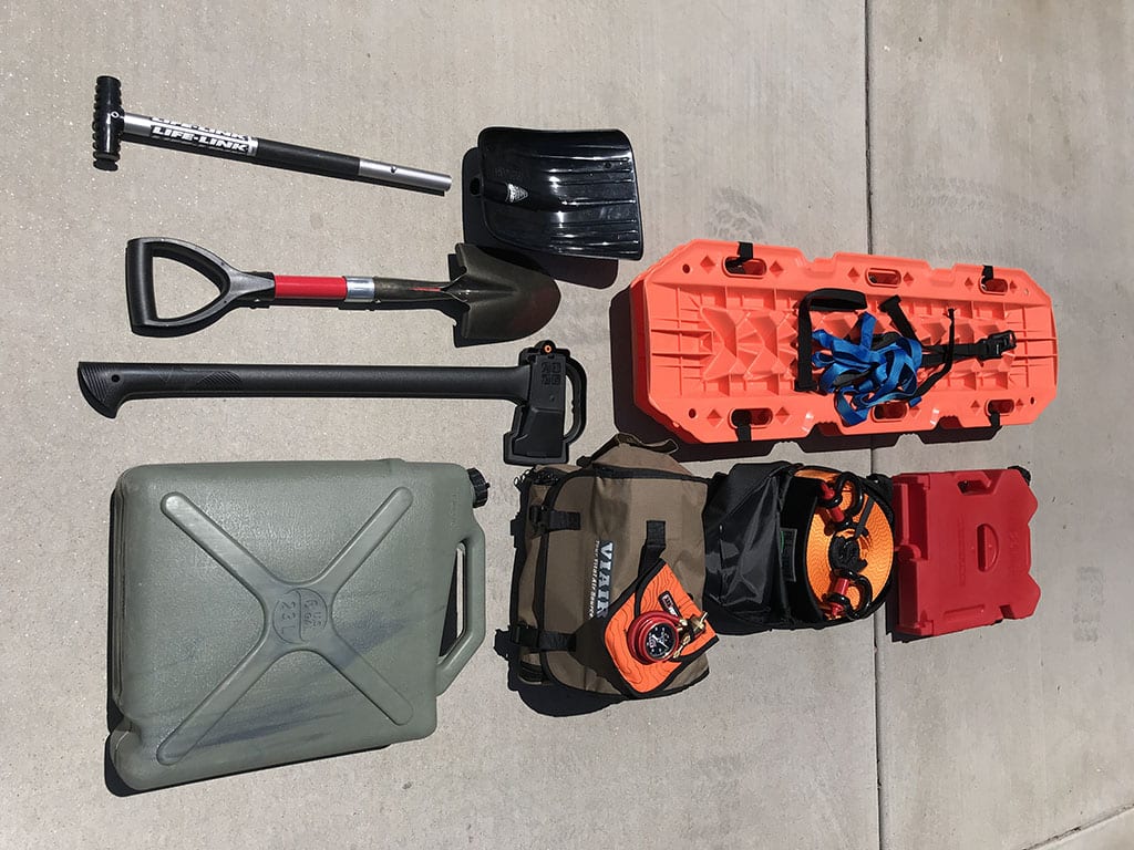
- Container for extra gas
- Container for water
- Air Compressor
- Shovel
- Sand Bridges or Traction Mats
- Ax
- Rope
Most of these items you hope to never use, and except for the water and air compressor, we never had to use the shovel, rope, and sand bridges for ourselves, but we have used them to help others get unstuck!
Tips for Driving to White Pocket
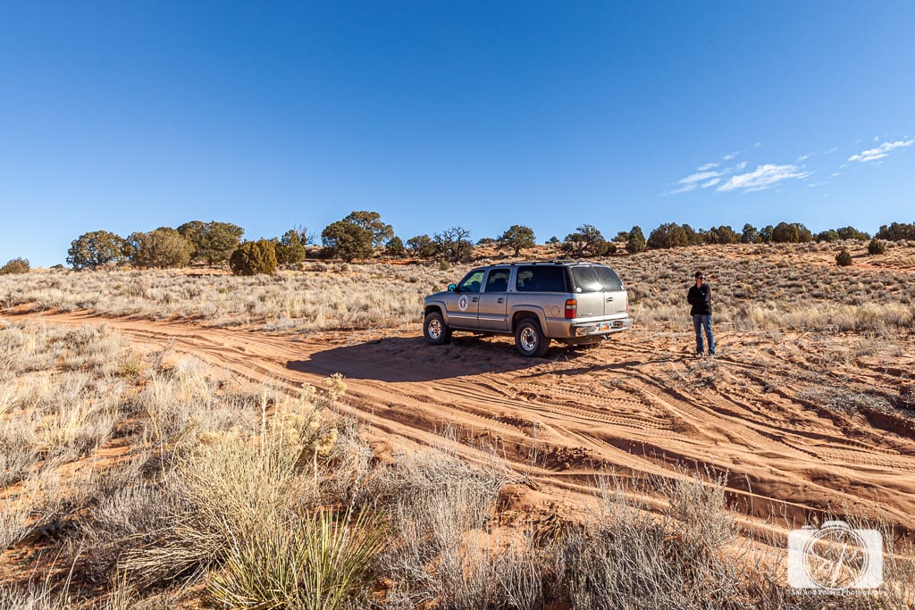
1. You MUST have a 4X4 with high clearance. NPS defines a High Clearance Four-Wheel-Drive (4WD) Vehicles as:
A high clearance 4WD vehicle is defined as a SUV or truck type vehicle, with at least 15 inch tire rims or more, with a low gear transfer case, designed for heavier type use than a standard passenger vehicle, with at least 8 inches of clearance or more from the lowest point of the frame, body, suspension, or differential, to the ground, also including a means to mechanically power both, front and real wheels at the same time.
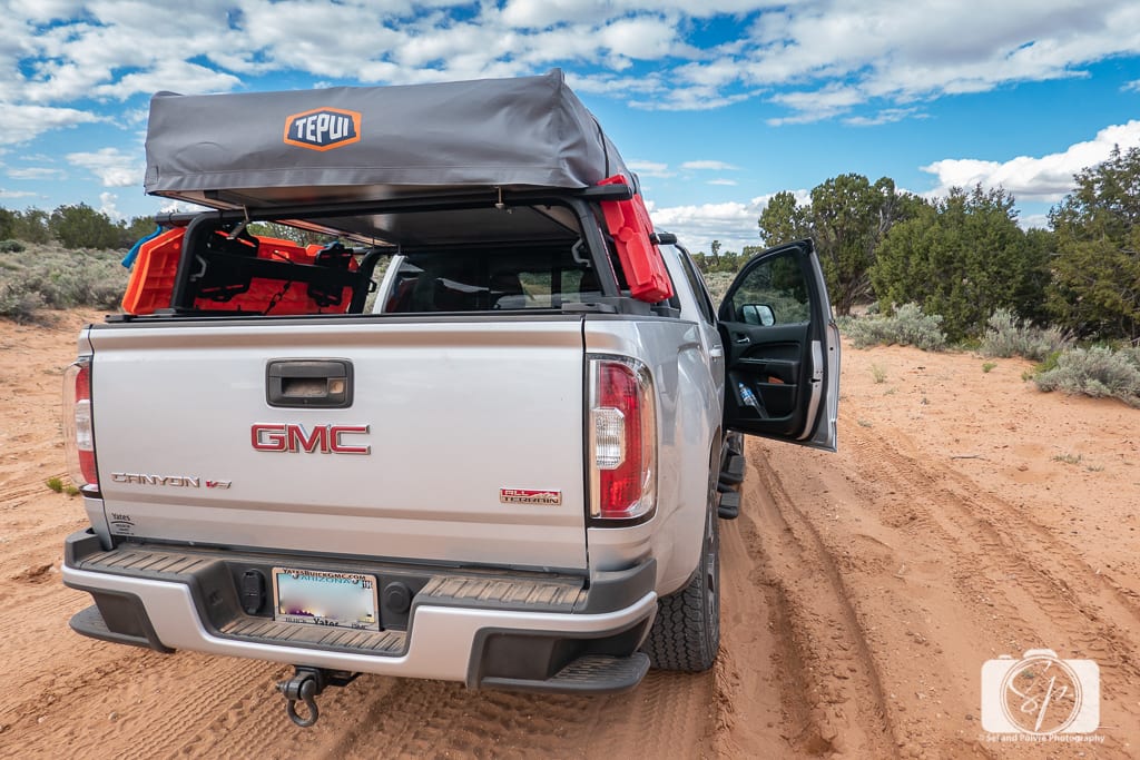
However, the higher, (9 or 10-inches) the better. With the definition 8-inches, that includes some vehicles that I would not try this road with (think Subaru). You will better off with Suburbans, Jeeps, high clearance trucks (like our GMC Canyon), land cruisers, hummers, or range rovers.
2. Lower your tire pressure. Lowering your tire pressure will greatly improve traction. When you start to get to the really sandy area, stop safely on the side of the road and remove air to reduce tire pressure to 20psi. Also, don't forget to increase the pressure on your way home!
3. Drive confidently. Drive smoothly and keep your momentum. Resist the urge to break especially if you slide on the sand. Keep going!
4. Call the BLM office in Kanab Before heading to White Pocket, call the BLM office to inquire about the road conditions before your trip. The BLM Kanab Field Office number is (435) 644-1200 and is located at 669 S. Hwy 89A in Kanab.
Where to Stay Near White Pocket
If you are coming from Las Vegas, Kanab is the best place to stay near White Pocket. Each time we come to Kanab there are more choices! During our last trip, new RV parks had been installed and local homeowners and now renting out their houses, apartments, and condos on Airbnb. So you have lots of choices.
If you are coming from Phoenix, the nearest large town to White Pocket is Page, which also has a large selection of hotels. You will also pass Lee's Ferry and Marble Canyon on Highway 89A where there are a few smaller lodges run by the Navajo Nation as well.
Remember, any of the options are still several hours away from White Pocket, so, if you want to photograph sunrise or sunset at White Pocket, you’ll want to plan an overnight stay at White Pocket. There are spots for several primitive campsites scattered around the parking area and across from the “lot”, offering easy early-morning access to the sandstone formations.
Camping at White Pocket
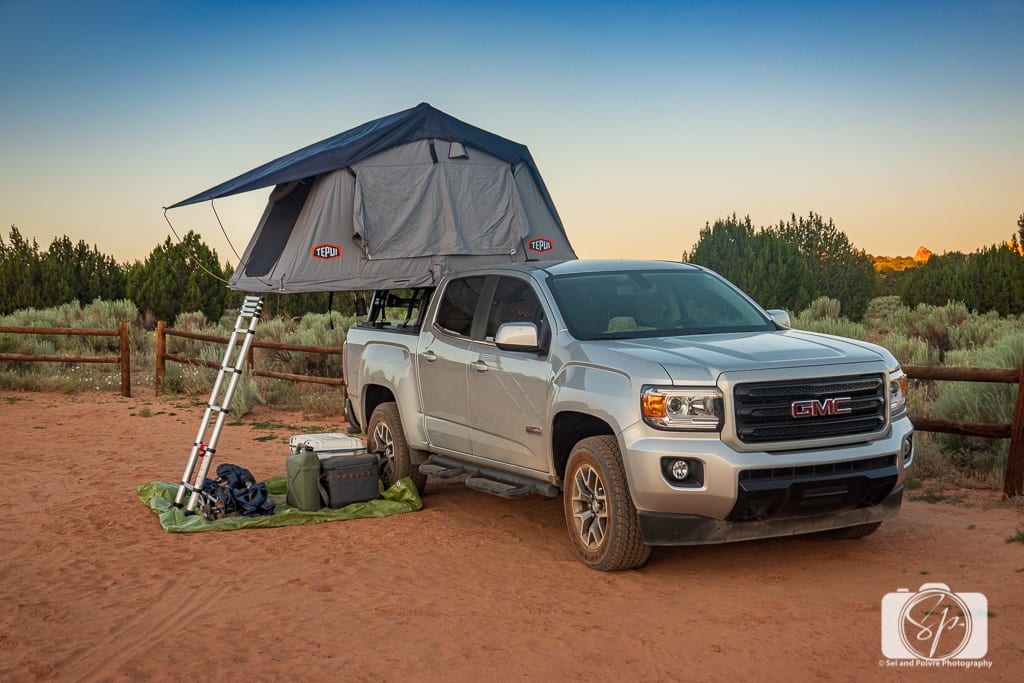
This is the best way to enjoy this area. We tent camped on the ground here in November 2012, It was absolutely freezing but the sky was so clear and gorgeous and as you can imagine, we were the only ones out there.
We camped 3 times in 2019, once on a holiday weekend in May. About 5 other people were camping so there was plenty of room to spread out and we camped with our Tepui tent across from the main lot.

We camped 2 additional times in 2019, another weekend in May in the “parking lot” area, and we were completely alone. We camped for a single night during the 4th of the July weekend with one other couple where we parked at separate ends of the lot.

IMPORTANT: when you arrive at the White Pocket parking lot, there is a road that goes off to the right and leads to a large rock that people camp on (there are some of the very rare trees that provide shade).
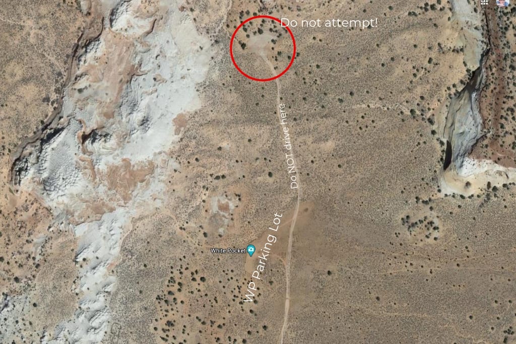
Unless you are a hardcore 4×4'er that is totally equipped to do so do NOT drive on this road. You will get stuck. Mr. Misadventures and I ourselves have pulled people off that road (we had the equipment, they did not!). It took hours!
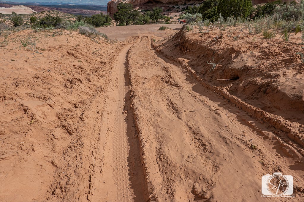
It looks innocent, you will be tempted, but do not do it! This is looking down the hill to that oh so enticing camping area. You may be able to get down to the camping area, but you will not be able to get back up the sandy hill to leave. We have witnessed (and helped stuck people) and heard the spinning of the tires time and time again.
Best Time to Visit White Pocket

Personal experience personal opinion: late spring and early fall.
The Vermilion Cliffs are located at an elevation of 6,000 feet, so don’t expect hot Arizona weather year-round. In fact, it can get quite cold if you visit this region in the winter. You might even have snow! The high desert also means cold nights most of the year except in the summer. We have camped at White Pocket in winter, and it was in the 30s.
We have camped in the spring with the temperature in the 40's and 50's in the evening. I have been in the summer where it was 100 during the day. Although White Pocket isn’t crowded, cold weather helps keep others at home! In summer, it can get pretty hot and there isn’t much shade, so plan accordingly.
Once you start getting rain or snow, the road is impassable. We tried once at the end of January in 2017 and couldn't get through, but successfully made it (with a guide) in February of 2013. Weather plays a factor. In the height of summer, the sand is pretty loose (not packed together with moisture) so tougher to drive on and easier to get stuck in.
Lastly, the region has flash floods from mid-July to mid-September during monsoon season, and being caught out on the road when one of those hits is dangerous and disastrous.
Tips for Visiting White Pocket
- There are NO facilities of any kind at White Pocket. That means whether you are doing a day trip or spending the night, you will have to plan accordingly. That means you will be using the bathroom outdoors, so whether that means squatting, a pee cup, or tinkle belle (!) you will need a tissue or something to wipe with (TP Kits) and something to bury waste with – sorry, this is a reality of going backcountry!
- No facilities also means NO water so you need to bring your water in. White Pocket is in the desert, even if it is the high desert, and you can become dehydrated quickly. You should bring way more water than you think you will need. Why?
- Depending on the time of the year, if you get stuck either on the road or at White Pocket, you might not see a BLM employee for a couple of days so you will want to have water (and some food) to last that long. Obviously, if you are camping this is something you will have already, but if you ate day-tripping that may not be the case.
- Of course, between our first trip in 2012 and now, you can sometimes now get cell coverage, but don't count on it!
- In the summer and warmer parts of spring and fall, but careful for rattlesnakes. If you are visiting during these times make sure to make noise as you walk on trails and along the rocks.
Things to Bring to White Pocket
Besides the equipment, you will need if you drive, there are a few other items you should be sure to have whether for a day trip or for camping.
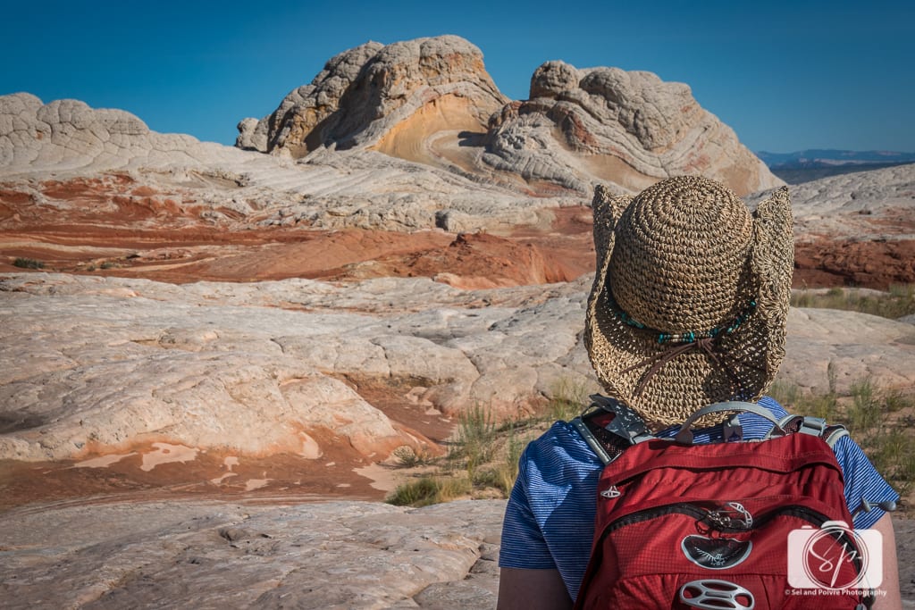
- Shade/Umbrella/Hat – there is little to no shade at White Pocket so if you are bringing your own car, bring something to create shade with a sunshade or shade shelter. Ours is from Kelty. Even if you are doing a day trip you may want to consider having something like this in your car, if you are road-tripping in the Southwest it is a nice thing to have. If you are visiting with a tour, consider an umbrella for additional shade. I always have several types of hats in the car at all times as well, including a baseball hat, a Wallaroo hat that protects me from too much sun and UV, and a knit cap for early morning and evenings when it gets cold. I sometimes brought a straw hat which was a little cooler in the heat of the day.
- Sunscreen/UV protection – this is another must-have for any visit to the Southwest. Even if it doesn't seem sunny, the UV is fierce. After ensuring you are well hydrated, this is the most essential thing you should do for your health and safety!
- Layers – it can be pretty chilly in the mornings and evenings, so consider layers that you can strip off as the day progresses. In a single day, I have gone from a full-jacket, ski hat, and gloves, to long-sleeves, to short-sleeves to long pants to shorts and back again!
- A Day Pack or Backpack – it is about .75 of a mile from the parking lot through the sand into the rocks, so you do not want to be traipsing back and forth to your vehicle to change hats, clothes, or supplies. I always have my old faithful, an Osprey Talon 22 backpack which I've had for more than 10 years!
Last Thoughts on White Pocket
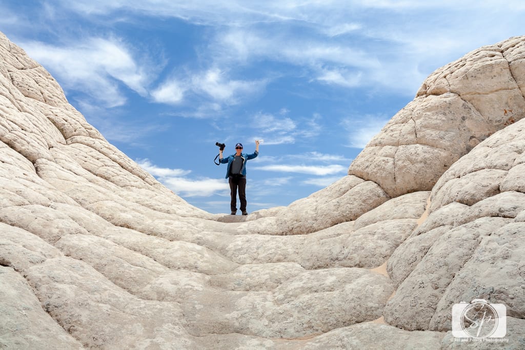
If you have been reading Misadventures with Andi for any length of time you know that I am a Francophile whose heart belongs to Paris (well to all of France). But as much as I love the City of Light, I hold White Pocket as dearly or as tightly given the Instagram world we live in with its rapid decline of places to go to truly escape the world. To find a spot like this, to have enjoyed as many times as I have with [generally] little to other humans has been one of my greatest joys. I feel at awe with nature and in peace whenever I visit this place.
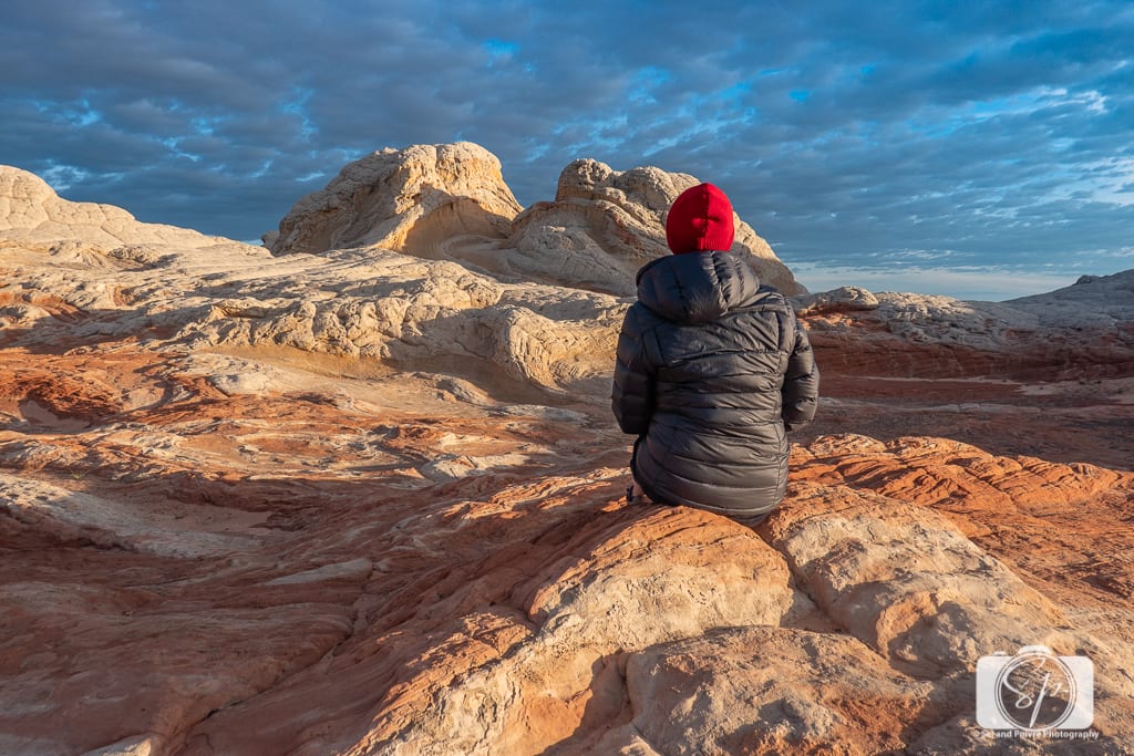
This place is not easy to love when you are freezing your ass off in the morning waiting for sunrise (or rather, waiting for the hubby to do the sunset!) but every time it has been worth it!

Or coming in winter and also freezing your ass off for sunset, but the reward is that the day is short and soon the crystal clear evening sky will be your reward.
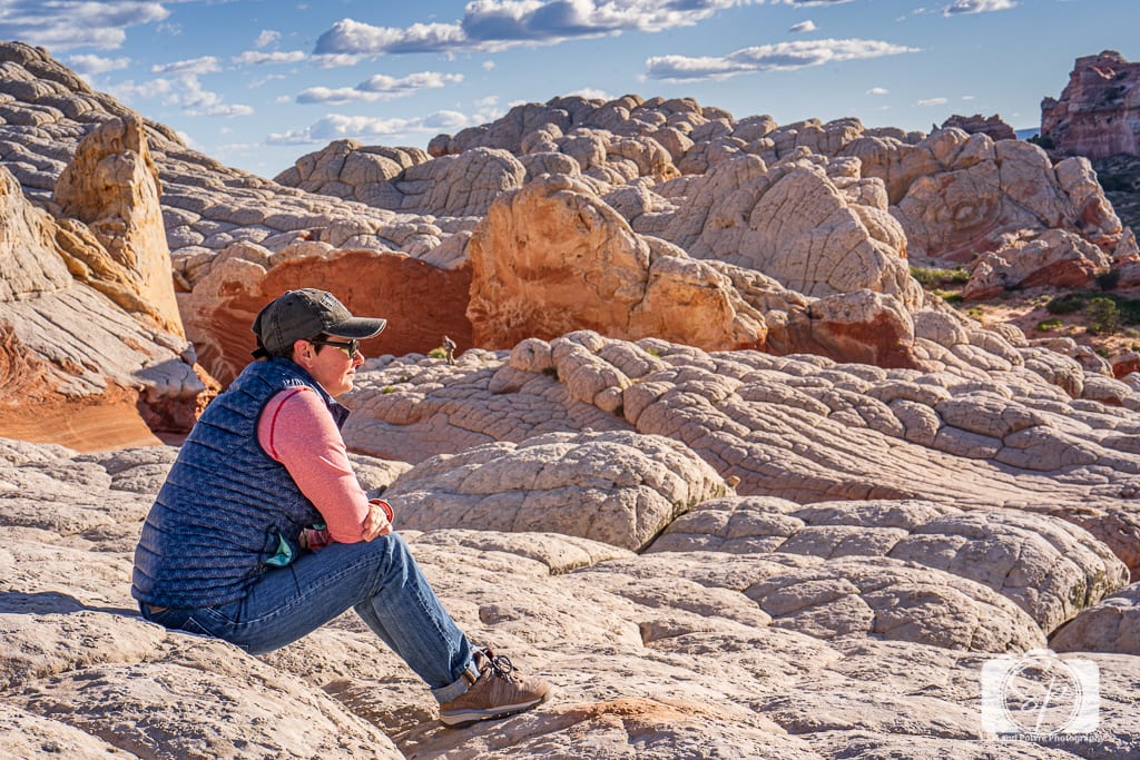
The Wave? The Wave who? The Wave what? You don't need no stinkin' Wave! White Pocket is the Wave alternative you need to see!
If you have the opportunity to visit White Pocket, please cherish and protect it. As the years pass, and more and more people visit, I fear that it will be destroyed. I ask you to visit responsibly, to leave it better than you found it and protect it. I am sure that in the new future it will require a permit to visit, but until such time, enjoy it.
 |  |
How about you? Have you heard of White Pocket? Have you been? Are you inspired to go? Do tell!
Like it? PIN it!
 |  |  |


Gorgeous photos… and love the little nod to misadventures!
@Walker, thanks!
Wow, what INCREDIBLE landscape photos! Looks like something out of a Dr. Seuss book!
@Katie, thank you, those are the misters!
I agree, these photos are incredible! As for what I’ve done for the sake of a photo op, I’ve climbed farther and higher than I probably otherwise would have just to take a picture of an incredible view. Not just to SEE the view but for the picture I can take and look at/share later–ha!!
@Patty, I feel you on that, I am not one for physical exertion, but to get content for the blog I have pushed myself a lot 🙂
These pictures are amaaaaaaaaazing!!!! I didn’t know you were a camper!
@AndiP, I totally am NOT 😉
Those photos are FAN-FREAKIN-TASTIC. And I’m with you: as much as I like pretty scenery and photography…I would have stayed in bed =)
@Kristin, hee-hee, it was pretty damn cold. And not something I would initiate to repeat!
These photos are magical. They remind me of my Magic Window with blue and white sand from the 70s. Have I said that before? Anyway, I think you are so brave and generous, Andi. Most women would not do this for their husbands. I hate being cold. You’re a trooper. I liked the line about unfettered-by-city-lights sky very much.
@Jen, oh I remember those window things – you are so right! The sky was pretty awesome. I guide has a great Google sky app that you just put to the sky and it mapped out all the constellations there were hundreds! My hubby and I couldn’t do it with our iPhones – no Google apps!
I wish I could go there as it is too remarkable to be real..too magnificient to be real and too Awesome, beautiful for simple wordage…How do I share this to my facebook?
Hi Andi,
Great story and awesome photos! I would love to visit White Pocket and thanks for sharing the info about the guides. I have been thinking about taking a road trip there and it is so nice to have these .great resources!
I have a home in Las Vegas and frequently visit a place 45 minutes outside of Las Vegas called “Valley of Fire.” It has very interesting rock formations and looks a little similar to the ones you are showing in the photos. If you visit Valley of Fire, you will see several different majestic landscapes all in close proximity and all very different. I would highly recommend Valley of Fire for a photo shoot and it is very easy to access.
Looking forward to reading about more adventures!
Henri
@Henri, hello there Instagram friend! Thanks for the compliment on the photos. My hubby and I actually love Valley of Fire. We head there every time we go to Vegas and I have posted about some of my visits. Such a beautiful place and relatively unknown.
The photos, the story – just GORGEOUS!
@Jennie, merci!
ty so much for sharing this. this is so beautiful I never even knew it exsisted 😀
There’s something magical about the desert sky. I love visiting my grandpa (who coincidentally lived in both Utah and Arizona) just so I could stand outside and stare at the stars. Isn’t it just lovely?
That is a gorgeous landscape & looks perfect for picture taking! I can see why anyone would want to go back for more!
I really enjoyed your photos and story of the Vermillon Cliffs. Your pictures are incredible. I am an amateur photographer who enjoyed taking photos on some of our hikes. I have hiked Canyonlands, Zion and Arches National Parks in Utah. We have also hiked extensively in Arizona locations of Walnut Canyon, Canyon de Chelly and the Chiricahua Mountain Range. and many more If you haven’t already done so you might want to photograph Chocolate Falls (officially Grand Falls) in Northern Arizona. No hiking envolved but certainly an incredible sight.
@Judith, those are some great spots you have mentioned and others I don’t know about. I am going to have to look them up!
Beautiful photos!
Hello! A beautyful Place! Amazing!
We will Go this year. So just a question. Can we do this alone (2 adults and 2 kids) or we have to take a tour?
@Christine, thank you, danke! You CAN do it alone BUT you MUST have a high-clearance 4×4 vehicle and depending on what time of year you may have problems with weather conditions like snow and rain. The first 2 times we went, we went with a guide, after that we went on our own. I am getting ready to update this post with the directions that include GPS coordinates. I can email you when I finish my update. If you do decide a guide I have Dreamland Safari Tours many, many, many times and HIGHLY recommend them!
Andi, I loved the pictures! The Landscapes are terrific! Felt in love with your post since I read the first paragraph. I hope I can go there some time. Awesome job!
I won’t lie, I’ve never heard of the Wave before (sounds pretty intense) but White Pockets seems like a place that should be on everyone’s American bucket list! It looks AMAZING and your photos are STUNNING!! Hopefully I can make my way there when we can travel again
What stunning photos! White Pocket is quite picturesque. I’ve seen hoodoos at Mono Lake in California. They are strange indeed!
What an outstanding looking place., thank you for sharing this. I had no idea somewhere as this exists. It looks like it belongs in a movie. Your photos are outstanding and so vibrant. I’d love to do this a road trip and camp out but agree that you’d have to be experienced with off-roading and navigating, but going with the guide like you suggested might take away that charm. It would be a dream to camp out and see the stars.
What a wonderful place! I have never heard of White Pocket in Vermilion Cliffs National Monument before reading your blog. I love rock formations and here are the best variety and colors too! Your photos are simply stunning. I am saving your blog for my bucket list.:-)
Wow what a stunning scenery! I am a big fan of the coordinates – thanks for that! 🙂
Nice photos! Thanks for sharing this.
How gorgeous. Those are amazing photographs of a unique and intricate landscape. I can just imagine how these rocks change color as the sun moves across the sky and the light reflects differently. It’s a special area of the country and one well worth visiting. We’ve been planning a road trip from Los Angeles to Santa Fe .. so hopefully we can add this memorable location to our itinerary.
So. Incredibly. Beautiful.My husbands trip out west was cancelled this April and he was so gutted, because he had a few special permits to see sites he’s worried he won’t get again. These photos are breathtaking. I’m going to share this with him though so he knows there’s alternatives though when he can plan again!
Wow, this place looks stunning. How have I not heard of White Pocket? I’ve travelled a lot around the states but for some reason, not made it to Arizona – yet!
Wow! What an amazing place & beautiful photos. I have to admit I’d never heard of White Pocket, which actually I’m sure bearing in mind everything you say is a good thing. I’ve not even heard of The Wave but it sounds like a popular spot & no doubt stunning! I hope it stays a secret so you can carry on enjoying it as it is (& so can I when I make it there)…but I feel after people read & see this post, it won’t be for long 😉
Wow. Absolutely gorgeous. We have been reminiscing about where we’ve lived lately and missing Arizona. Jenn has also been jonesing to get photos that clear and crisp. We are probably going to rent a camera in the next couple of weeks to see if it’s an equipment problem. Looks like a fantastic alternative to the Wave.
Stunning colors in nature. Love all your images and how cool that you got to car camp in this area. That night sky shot is brilliant.
Amazing photography. The waves look stunning. Thanks for sharing these secrets.
What a beautiful place to explore. I am just awed at the rock formations. Thinking to myself what caused it to look that way and how many years did it take to create such naturally beautiful landscapes! I hope to be able to visit someday!
Those colors are AMAZING! I love the contrast between the warmth of the rocks and the sand and the coolness of the sky. Your post is very detailed and now that you gave me the desire to visit there, I will definitely use your recommendations.
Holy cow this is extensive! I’m still unpacking it. Thank you!!
WOW! Amazing shots of a gorgeous place! I’ve heard of The Wave, but not this place and I lived in AZ for 20 years. Thank you for sharing all these detailed and helpful tips.
Wonderful photos!!! I can’t stop scrolling again and again…
Wow, how is this place even real? I hope to visit one day! Thanks for the detailed post!
What a cool insider tip! I like how thorough it is, really helpful for anyone who wants to visit themselves. also enjoyed the photographs and that they were separated into different categories 🙂
The first photo of yours with delicate rock formations at White pocket as won me over for this place. Before reading your post, I was having no idea of white Pocket but now it has intrigued me a lot due to lovely and natural creations of rocks. I am amazed to see night photography here. Good to see spring flowers blooming here as I never thought flowers in these rocks.
Wow, I love your pics Andi of the White Pocket waves in Vermilion Cliffs National Monument! They look so cool and I love the way our planet and environments create neat features like this! That whole area of Arizona is just so beautiful but I think exploring the White Pockets at night would be amazing cause your pic is truly beautiful! I think it would be really cool to see all the different animals of the area. Personally, though, the Petroglyphs would be my second if not number 1 thing to see!
I LOVE finding alternatives for busy attractions! The pictures of beautiful! Thanks for sharing these tips!
Great pictures. I missed White Pocket on my road trip, so I’m now adding it to the list. Thanks for the inspiration!
Wow can you take me here right now!! Your photos are amazing and the scenes are stunning too xx
I was in Arizona for a while last year but never did end up making it out there–would love to go there someday! Thanks for putting this together! :] Your photos are gorgeous!
Wow! It looks incredible. Hopefully with those crazy driving directions, it stays off of tourists’ radars and is kept a secret!
Wow this place looks beautiful and incredible. You’re photos looks stunning I would love to visit this place someday.
This place looks like it is not of this world! WOW. And your photos are absolutely stunning. In one of the pictures, it literally looks like you were walking on the moon!
This is such a great guide! White Pocket is a wonderful place and we camped there for a few nights and loved it. I could have spent weeks wandering around and taking photos!
That photo with the stars in the background is just stunning. Seriously, this whole place looks like Mars – they could totally film movies here lol! Hopefully the movie industry doesn’t discover it though, and it can be a secret alternative location just for your blog readers 🙂 (we wish!).
I have never heard of white pocket earlier until now, it is really beautifully. The photography is amazing.
Please tell your husband his pics are stunning! I haven’t been to this area, but when I lived in CO I spent a bit of time in southern Utah doing some canyoneering. Plus I spent time in places like Canyonlands NP, Zion NP. The rock formations all through this part of the USA are just the coolest ever. Your post and the images brought back some great memories for me.
Wooooow Andi! Your photos are truly gorgeous. White Pocket looks like a stunning area to hike and take photos.
This looked like such an amazing experience! The photos are AH-MAZING! Adding this trip to my bucket list. Very informative post. Thanks for sharing.
Great photos and narratives!
What an insanely beautiful place! Utah is on my list of places to visit, it looks absolutely stunning and I’d love to explore the desert more. Also major truck envy, I’d love a tent set up! x
Your photos are so beautiful! I was planning a backpacking trip in Arizona before COVID happened, can’t wait till I get to go!
Beautiful photos. What a stunning nature. I loved reading your story. You’re so lucky you’ve had chance to experience such an amazing place.
Absolutely stunning photos. Thank you so much for putting this place on my radar. I cannot wait to visit it.
I definitely really want to visit The Wave, but I love that you’ve given us such a beautiful alternative! I’ve never heard of White Pocket and I guess that makes sense since the Wave is so popular. Also, that caterpillar is crazy pretty!
Thanks for the nice write up on White Pocket…was just doing a search for some inspiration…ive been there once before and hope to get back this fall/winter in my Subaru 😉
I have mixed feelings when I read about your love of the place and how you fear it will be destroyed…I feel the same way about some of the spots I photograph and share on social media, it drives more visitors to the area and not all are as respectful of the land as I am, so I am playing a role in their destruction. I’d like to think that by showing a place’s great beauty you are helping protect it, but in this instagram society the opposite is often true. By heavily promoting a location, it will drive up the numbers and when it is as sensitive as white pocket, the result is usually bad. Not sure what the solution is, but I certainly have considered just stopping the posts all together–I have to promote my photography somehow, but it has to be done with concern for what it is I am sharing!
@Stan, I agree with the internal battle and the balance. The one good thing about White Pocket is that it is still semi-difficult to get to, although I do not know how much longer that will be the case…
What a great article/information and photos. lol…I wish I would have read this before I went to White Pocket as I went down that sandy road that you say “Do not attempt.” I actually made it past the sand to the rock area without much trouble, which BTW would have been a fantastic place to camp, but there were already a few people there, so, I made a big loop and turned back. It was the going back part that I had serious trouble. I went up the sandy hill and came to an abrupt stop, just past the top. I decided to back down, making sure I stayed in my tire marks. I backed up as much as I could on the rock surface and just pushed the gas to the floor to get a good running start. My engine was so bogged down and struggling to get through. Then, there were a couple of women walking on the tire paths right in front of me. There was no way I was going to slow down or stop, otherwise I would never have gotten out of there. I laid on the horn and held the pedal to the floor. I just barely make it out. Such a fantastic place to visit. I want to go back one of these days for sure.
Oh Mike! “Told y’a!” I have seen soooo many people stuck there! We spent 2 hours our last trip getting a car up that hill! It is an amazing spot, one of my favorite places in the world!
Such stunning photography. Just WOW!
Stunning photo!
Is there a tour guide to White Pocket from Sedona or Page?
@mary, yes there is. Page is the better option, but the best option is actually Kanab. There are several very good guides from Kanab.
Hi Andi,
Great pictures. Would like to know when did you take the pictures with water reflection from the small pond? in December or February? What is the best season for the reflection?
Thanks.
@Steven, those were actually on a trip in late April. I would say spring or late fall when there is a good chance of rain but not the flash floods you can get between July and Sept.
@Andi Fisher, Thank you very much.
Have mountain biked just across 89 and not heard of this place, thank you.